Skip to content
Get the Balanced News app for a better experience!
The Balanced News Logo
Analytics
The Balanced News Logo

Stay Balanced, Stay Informed

Menu
  • Browse News
  • Underreported Stories
  • Curated Feeds
  • Insights
  • Analytics
  • Our Writers
  • About Us
  • Download App
Learn
  • How It Works
  • Bias Detection
  • Lens Score
  • Source Bias Checker
  • Accountability
  • Custom Feeds
Newsroom
  • Writers & Analysts
  • About TBN
  • Editorial Standards
  • Corrections Policy
  • Our Partners
  • Insights
Socials
  • Youtube
  • Instagram
  • X
  • Facebook
News Categories
  • Trending
  • Politics
  • Sports
  • Business
  • Tech
  • Entertainment
  • Health
  • Science
  • Crime
  • Lifestyle
  • National
  • International
  • Good News
  • Crypto

Get Our App

Available for iOS and Android


LensFeedsInsightsAnalyticsTrendingGood NewsSportsPoliticsBusinessCrimeTechEntertainmentHealthNationalInternational

© 2026 The Balanced News. All rights reserved.

About UsEditorial StandardsCorrectionsHelp & SupportPrivacy PolicyTerms & Conditions
UN Endorses Equal-Area Map Projections to Improve Continental Size Representation
Categories

Categories

Related Coverage

Select a news story to see related coverage from other media outlets.

Related Coverage

Select a news story to see related coverage from other media outlets.

  1. Home
  2. /
  3. Education

UN Endorses Equal-Area Map Projections to Improve Continental Size Representation

Analysed 18 Sept 2026·2 sources analysed·India·Education
UN Endorses Equal-Area Map Projections to Improve Continental Size RepresentationPreviousNext

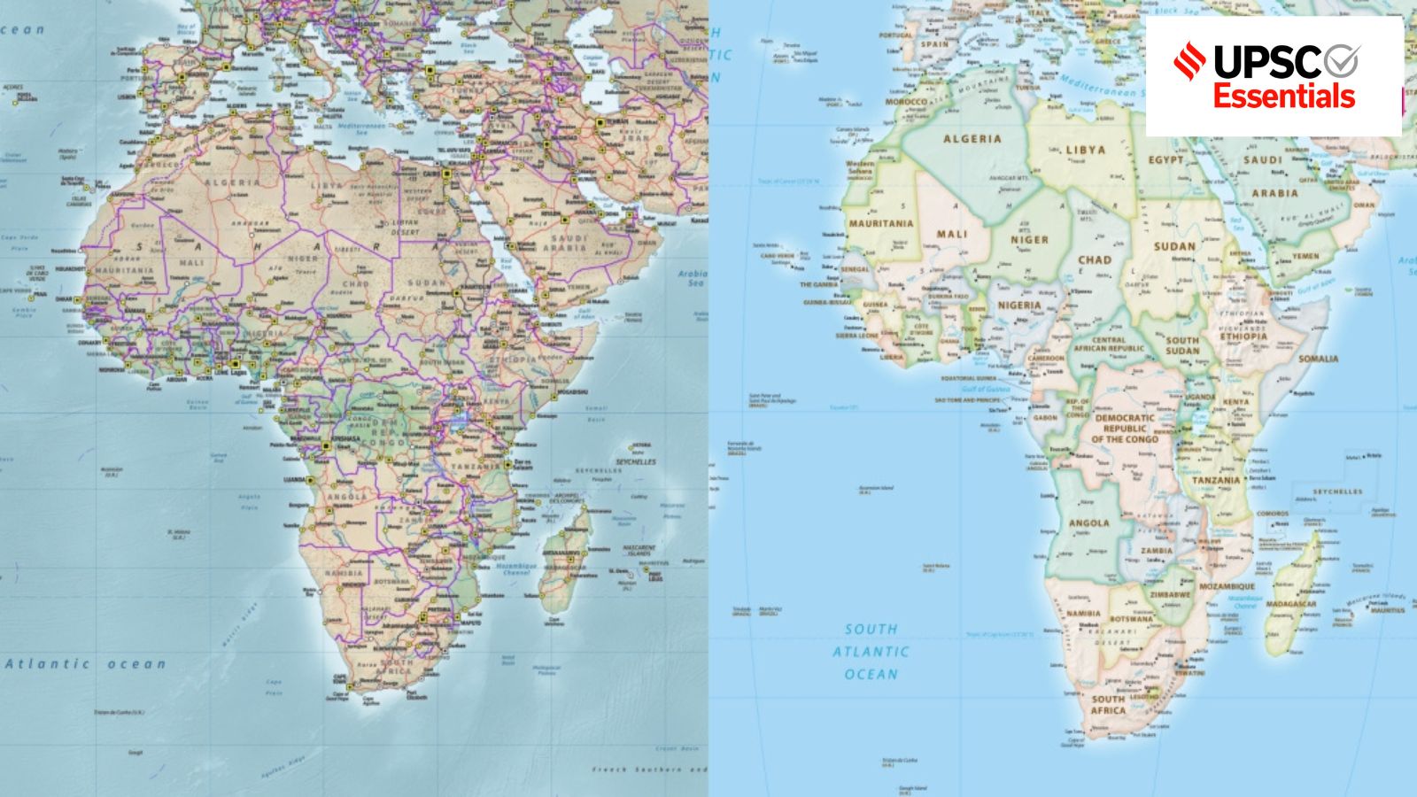
The United Nations General Assembly recently endorsed a resolution promoting the use of equal-area map projections, such as the Equal Earth projection, to better represent the true size of continents. This move aims to address distortions in traditional maps like the Mercator projection, which preserves direction but exaggerates area near the poles. The resolution, supported by 164 countries, encourages diverse map uses depending on purpose, highlighting the political and social significance of cartography in reflecting global realities.

Sentiment
62%
TBN's observations

First-hand measurement across 2 sources

We measured how 2 outlets covered this story. No outlet gave this story a measurable political slant — there is no left–right reading to report. Overall sentiment is positive (62/100). Lens Score 38/100.

Outlets measured: indianexpress, thestatesman. See how each one headlined and framed the same story in the source comparison below.

AI analysis of 2 sources · Published under editorial oversight by The Balanced News
Analysed 18 Sept 2026· How this analysis is produced· Editorial standards· Corrections

AI Analysis

Sentiment — Positive (62/100)

Sentiment was consistent across outlets (52–72/100), indicating broadly factual reporting rather than editorialising.

Coverage timeline

thestatesman broke this story on 18 Sept, 03:09 am. Other outlets followed.

18 Sept, 03:09 am2 sources · 12 h18 Sept, 03:12 pm
  1. 1
AI analysis by the TBN Bias Engine · beat methodology byOjas Kale· Founder & Editor
← Previous
UPSC Essentials Quizzes Cover Economy, Environment, and Defence Topics
Next →
RGIPT Sivasagar Campus Opens New Girls' Hostel to Expand Student Accommodation
thestatesman18 Sept, 03:09 am
Another way to see the world
  • 2
    indianexpress18 Sept, 03:12 pm
    How cartography's history mirrors changing socio-political realities
  • Who's involved

    Institutions and figures named across source coverage.

    Government
    United NationsUnited Nations General AssemblyIndian government
    Political
    African Union

    Story context

    Category
    Education
    Location
    India
    Sources analysed
    2
    Last analysed
    18 Sept 2026
    Key entities
    Equal Earth projectionEquatorCartographyEuropeIndiaMap projectionSpherical EarthNavigationContinentMercator projectionWorld mapUnited Nations