Mumbai Authorities Use Satellite and GIS Technology to Monitor Unauthorized Developments
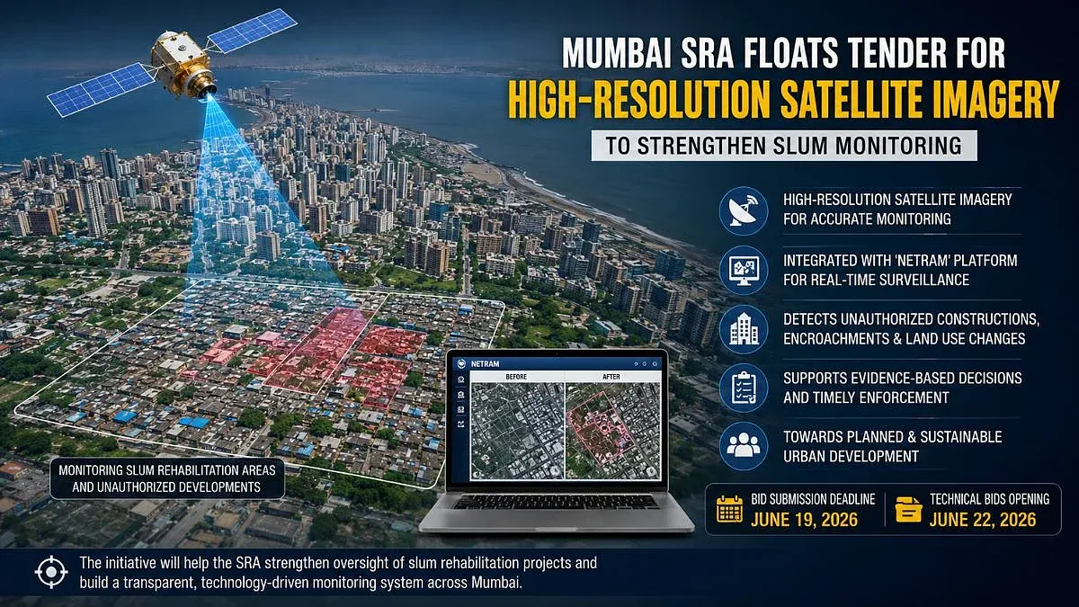
Mumbai's Slum Rehabilitation Authority (SRA) and Maharashtra State Road Development Corporation (MSRDC) are adopting advanced geospatial technologies, including high-resolution satellite imagery and GIS, to monitor unauthorized constructions, encroachments, and illegal hoardings. SRA plans to integrate updated satellite data with its Netram platform for enhanced slum rehabilitation oversight, while MSRDC will conduct detailed surveys using GPS mapping, drone surveys, and satellite imagery to create a digital database for enforcement across its jurisdiction.
First-hand measurement across 2 sources
We measured how 2 outlets covered this story. Coverage leans balanced overall (Left 0%, Centre 100%, Right 0%). Overall sentiment is neutral (65/100). Lens Score 36/100 — moderate-to-low public interest.
Outlets analysed (first-hand measurement by TBN's Bias Engine):
- hindustantimes— balanced framing, neutral sentiment
- freepressjournal— balanced framing, neutral sentiment
AI Analysis
The articles present a government-focused perspective emphasizing technological initiatives by Mumbai's SRA and MSRDC to improve urban monitoring and enforcement. Both sources highlight official statements and plans without critique or opposition viewpoints, reflecting a neutral, administrative framing centered on regulatory efforts and urban management.
The tone across the articles is largely neutral and informative, focusing on the deployment of technology to address unauthorized developments. Coverage is positive regarding the potential for improved monitoring and enforcement but does not include evaluative language or stakeholder reactions, resulting in a balanced, factual presentation.
How 2 sources covered this story
Each source's own headline, political lean, and sentiment — so you can see framing differences at a glance.