Satellite Imagery Reveals Extensive Gaza Destruction After Nearly Three Years of Conflict
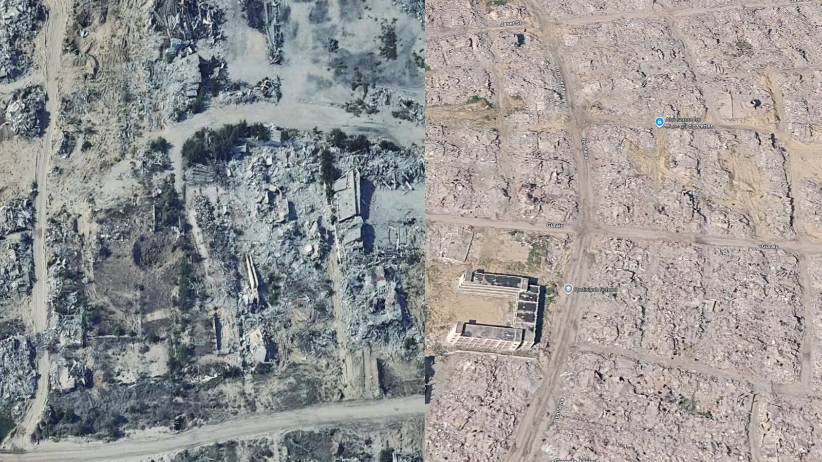
New satellite imagery from Google Maps and Google Earth's Detect Change tool reveals extensive destruction across the Gaza Strip nearly three years into the Israel-Hamas conflict. United Nations assessments report that about 82% of Gaza's structures, over 201,000 buildings, have been damaged or destroyed as of June 2026. The imagery shows significant changes in neighborhoods, farmland, and infrastructure, providing a visual record amid restricted journalist access to Gaza. The tools offer detailed comparisons of physical changes over time without attributing responsibility for the damage.
First-hand measurement across 2 sources
We measured how 2 outlets covered this story. No outlet gave this story a measurable political slant — there is no left–right reading to report. Overall sentiment is negative (33/100). Lens Score 64/100.
Outlets measured: indianexpress, httpswwwoutlookindiacom. See how each one headlined and framed the same story in the source comparison below.
AI Analysis
Sentiment was consistent across outlets (28–38/100), indicating broadly factual reporting rather than editorialising.
Coverage timeline
httpswwwoutlookindiacom broke this story on 29 Sept, 09:59 am. Other outlets followed.