ISRO Provides 33 Flood Inundation Maps to Assam During Monsoon Season
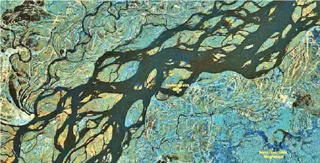
The Indian Space Research Organisation (ISRO) provided 33 flood inundation maps and related products to the Assam State Disaster Management Authority until July 28 this monsoon season, according to Union Minister Jitendra Singh. These maps use Synthetic Aperture Radar (SAR) and optical satellite data to offer near real-time and historical flood information, aiding in planning, rescue, and relief efforts. ISRO also employs global satellite data and advanced processing techniques to generate district-level flood reports, with data accessible via the National Database for Emergency Management portal.
First-hand measurement across 2 sources
We measured how 2 outlets covered this story. No outlet gave this story a measurable political slant — there is no left–right reading to report. Overall sentiment is neutral (52/100). Lens Score 49/100.
Outlets measured: theassamtribune, news18. See how each one headlined and framed the same story in the source comparison below.
AI Analysis
Sentiment was consistent across outlets (50–55/100), indicating broadly factual reporting rather than editorialising.
Coverage timeline
news18 broke this story on 5 Aug, 02:31 pm. Other outlets followed.
- 1