Skip to content
Get the Balanced News app for a better experience!
The Balanced News Logo
Analytics
The Balanced News Logo

Stay Balanced, Stay Informed

Menu
  • Browse News
  • Underreported Stories
  • Curated Feeds
  • Insights
  • Analytics
  • Our Writers
  • About Us
  • Download App
Learn
  • How It Works
  • Bias Detection
  • Lens Score
  • Source Bias Checker
  • Accountability
  • Custom Feeds
Newsroom
  • Writers & Analysts
  • About TBN
  • Editorial Standards
  • Corrections Policy
  • Our Partners
  • Insights
Socials
  • Youtube
  • Instagram
  • X
  • Facebook
News Categories
  • Trending
  • Politics
  • Sports
  • Business
  • Tech
  • Entertainment
  • Health
  • Science
  • Crime
  • Lifestyle
  • National
  • International
  • Good News
  • Crypto

Get Our App

Available for iOS and Android


LensFeedsInsightsAnalyticsTrendingGood NewsSportsPoliticsBusinessCrimeTechEntertainmentHealthNationalInternational

© 2026 The Balanced News. All rights reserved.

About UsEditorial StandardsCorrectionsHelp & SupportPrivacy PolicyTerms & Conditions
iFOREST Launches Multi-Satellite Dashboard to Monitor Crop Residue Burning
Categories

Categories

Related Coverage

Select a news story to see related coverage from other media outlets.

Related Coverage

Select a news story to see related coverage from other media outlets.

  1. Home
  2. /
  3. Technology

iFOREST Launches Multi-Satellite Dashboard to Monitor Crop Residue Burning

Analysed 6 Nov 2026·2 sources analysed·Haryana, India·Technology
iFOREST Launches Multi-Satellite Dashboard to Monitor Crop Residue BurningNext

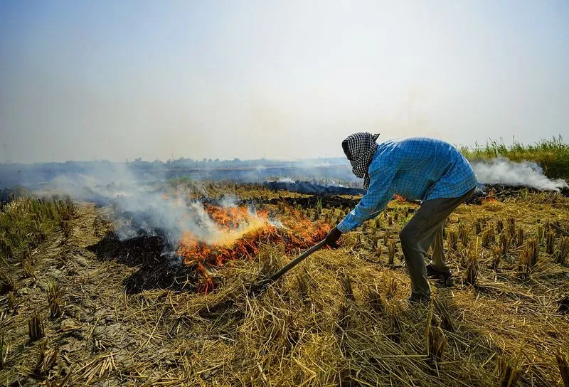
The International Forum for Environment, Sustainability and Technology (iFOREST) has launched Fire Watch, a multi-satellite online dashboard that provides a comprehensive view of crop residue burning. Covering Punjab, Haryana, Uttar Pradesh, and Madhya Pradesh, it tracks the number and location of active fires, peak burning times, and the area affected during the season. Fire Watch integrates data from polar-orbiting and geostationary satellites, along with high-resolution imagery, to offer more detailed information than traditional fire counts, aiding policymakers and the public in designing interventions.

Sentiment
54%
TBN's observations

First-hand measurement across 2 sources

We measured how 2 outlets covered this story. No outlet gave this story a measurable political slant — there is no left–right reading to report. Overall sentiment is neutral (54/100). Lens Score 42/100.

Outlets measured: thetribune, hindustantimes. See how each one headlined and framed the same story in the source comparison below.

AI analysis of 2 sources · Published under editorial oversight by The Balanced News
Analysed 6 Nov 2026· How this analysis is produced· Editorial standards· Corrections

AI Analysis

Sentiment — Neutral (54/100)

Sentiment was consistent across outlets (52–55/100), indicating broadly factual reporting rather than editorialising.

Coverage timeline

hindustantimes broke this story on 6 Nov, 02:28 am. Other outlets followed.

6 Nov, 02:28 am2 sources · 2 h6 Nov, 04:12 am
  1. 1
AI analysis by the TBN Bias Engine · beat methodology byAshwin Alsi· Technology Editor· editorial standards byOjas Kale
Next →
Flipkart and Reliance Digital Offer Discounts on iPhone 17 Series with Exchange and Bank Offers
hindustantimes6 Nov, 02:28 am
Online dashboard offering fuller picture of farm fires unveiled
  • 2
    thetribune6 Nov, 04:12 am
    Dashboard launched to map stubble burning
  • Story context

    Category
    Tech
    Location
    Haryana, India
    Sources analysed
    2
    Last analysed
    6 Nov 2026
    Key entities
    Fire Watch (short story)Crop residueHaryanaPunjab, IndiaUttar PradeshSatelliteMadhya PradeshStubble burningSustainabilityPolar orbitModerate Resolution Imaging SpectroradiometerMeteosat 8